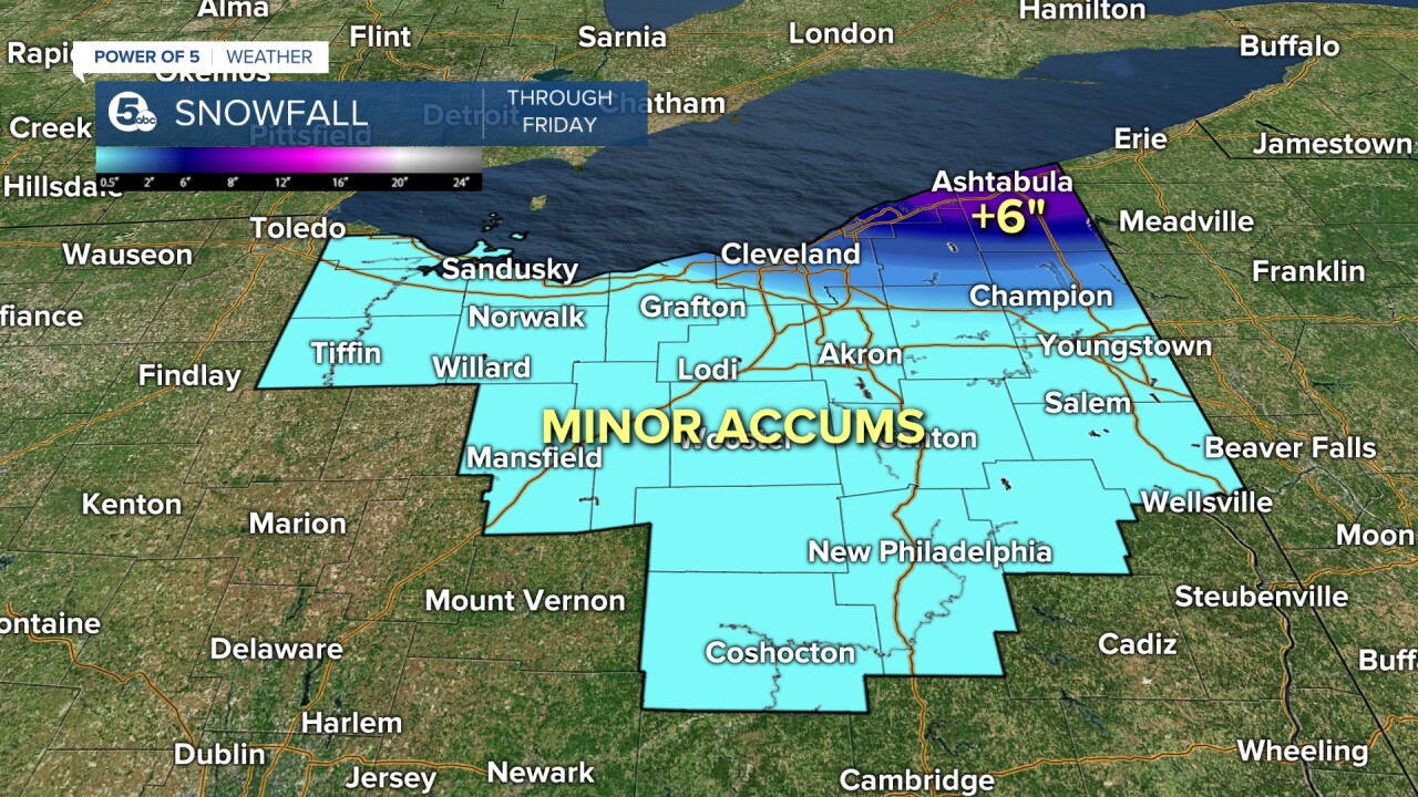
LAKE EFFECT SNOW WARNING for Ashtabula County.
WINTER WEATHER ADVISORY for Lake & Geauga Counties
Lake effect snow setting up today. It'll be relatively unorganized through midday with only minor accumulations along the lakeshore and east of Cleveland. Temps stay in the 30s, gusts as high as 30mph and wind chills in the 20s.
West winds take over tonight and fuels one massive lake effect snow squall focused on the primary snow belt. Lake, northern Geauga and Ashtabula county could be in the 1" to 2" per hour snow range.
Plan on a couple inches on the ground during the morning drive. That will impact the drive to work/school. Things settle through the day with less snow by midday. We're drying Thursday with cold air settling in and scattered lake effect during the rest of the day.
Friday's Lake effect snow is limited to far northern Ashtabula.
Even colder air will drop in for the end of the work week through next weekend. Look for high temperatures in the lower 30s beginning Friday with overnight lows by Saturday morning in the teens!
Stay warm everyone.
What To Expect:
- Winter coats needed all week long
- Significant lake effect snow Wed-Thursday morning
- Drying out late week
- Even colder by the weekend
- Single digit wind chills by Friday into Saturday
Daily Breakdown:
Wednesday Night: Lake effect likely.| Low: 31º
Thursday: Cold with isolated lake effect east.| High: 37º
Friday: Even colder. | High: 32º
Saturday: Partly cloudy. Cold.| High: 31º
Sunday: Staying cold with a weak clipper rolling through.| High: 30º
Monday: More sunshine, not as frigid. | High: 39º
Tuesday: Much brighter and warmer. | High: 44º
Our sister station WBKW has an early projected forecast.
Download the News 5 app for the latest weather updates:
Follow the News 5 Weather Team:
Mark Johnson: Facebook & Twitter
Trent Magill: Facebook & Twitter
Katie McGraw: Facebook & Twitter
Phil Sakal: Facebook & Twitter


