


CLEVELAND — All of NE Ohio now under a Winter Storm Warning which begins at 7 PM around Cleveland, 10 PM around Akron & 1 AM Thursday down around Carrollton & New Philadelphia. Winter storm warning lasts until 7 AM Friday north/central counties and 10 AM Friday for SE counties.
There is a LOT to unfold with this storm. Timing, precip, temperatures, location... all important. Rain will continue through the late afternoon & will bring it's own issues before the cold. Plan on snow melt plus downpours leading to high water. Frozen rivers and creeks will compound the slow runoff. Be aware of the roads and take it easy today.
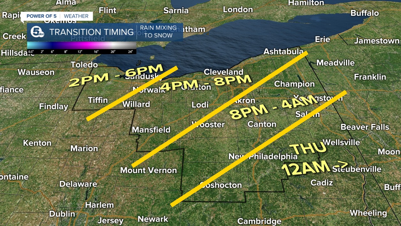
The cold air starts encroaching for late afternoon and evening. That means a transition from rain to freezing rain and then sleet for the evening and nighttime. It'll happen later E/SE than W/NW and take longer to fully change over to snow south. So we have rain, then freezing rain, then sleet all before the snow. Once it changes to snow it's all snow until late Thursday through early Friday.
Then it's all about the cold. With the snow numbers I'm not too worried about power outages. With the ice number though... I am. Especially south of Canton. Check out the ice and snow numbers above. any ice totals over 1/2" are significant.
Stay tuned for more specific details on totals, precip type, & amounts as we go through this event!
FORECAST HEADLINES
- Snow and sleet tonight
- 1 to 4 inches of snow by 8am Thursday
- Heavy snow likely Thursday afternoon and evening
- An additional 4-8" of snow by evening
- Significant impacts likely Thu/Fri
- Quiet this weekend but cleaning up from winter storm
DETAILED FORECAST
Wednesday Night: WINTER STORM WARNING! Rain changing to snow and sleet. 1-4" of snow by 8 am. | Low: 24º
Thursday: WINTER STORM WARNING! Heavy snow possible, especially during the afternoon. 4-8" of snow possible. | High: 27º
Friday: Light snow and flurries early. Very cold.| High: 19º
Saturday: Mostly cloudy & cold. | High: 22º
Sunday: Mostly cloudy & cold. | High: 30º
Download the News 5 app for the latest weather updates:
Follow the News 5 Weather Team:
Mark Johnson: Facebook & Twitter
Trent Magill: Facebook & Twitter
Remeisha Shade: Facebook & Twitter
Katie McGraw: Facebook & Twitter
