

CLEVELAND — Make sure you have a way to get alerts while you're out today. Intense heat and humidity building through that afternoon and eventually fueling strong storms. Tiing will range from early afternoon along the lakeshore to as late as sunset south of Akron. Heavy rain, hail, damaging wind gusts and frequent lightning are the main threats. The strongest storms may even produce a tornado. All modes of severe weather are possible.
We'll still be dodging a few t-showers early Wednesday but they end early. We're actually dry, breezy, and comfortable most of the Wednesday.
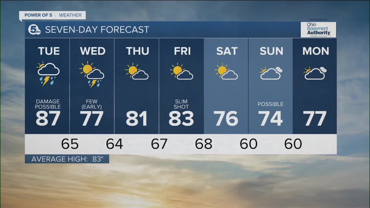
We'll get back to the norm Thursday and Friday before afternoon highs drop back into the 70s this weekend. Make plans to get outside!
What To Expect:
- Humidity lingers
- Damaging storms this afternoon
- Much more comfortable mid-week
Daily Breakdown:
Tuesday: Strong storms likely. | High: 87°
Wednesday: Storms ending early followed by MUCH more comfortable air. | High: 77°
Thursday: Low humidity and GREAT. | High: 82°
Friday: Slim shot for a storm. Partly cloudy. | High: 83°
Saturday: Comfortably warm. | High: 78°
Download the News 5 app for the latest weather updates:
Follow the News 5 Weather Team:
Mark Johnson: Facebook & Twitter
Trent Magill: Facebook & Twitter
Katie McGraw: Facebook & Twitter
Phil Sakal: Facebook & Twitter
