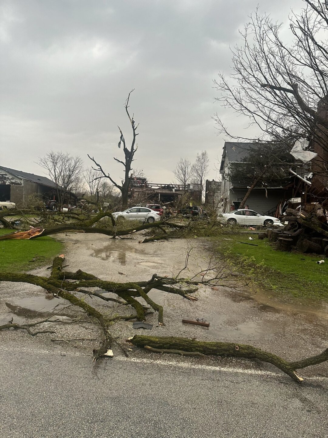
Severe weather hit the News 5 viewing area Wednesday afternoon into the evening, and it brought plenty of watches and warnings with it.
Earlier, a Tornado Warning was issued for Ashland, Holmes, Trumbull, Portage and Richland counties, all of which expired by 7:45 p.m.
News 5's Mark Johnson said two tornadoes touched down Wednesday evening in Northeast Ohio. One was located in Portage County, and the other one was in Trumbull County.


Previously, there was a Tornado Watch issued until midnight for several counties across Northeast Ohio; however, it was canceled around 8:50 p.m.
PHOTOS AND VIDEOS:


What comes to mind when you hear "Watch" or "Warning?" Those words are often misunderstood. But what's the difference between a Severe Thunderstorm Watch and a Severe Thunderstorm Warning? Or a Tornado Watch and Tornado Warning? Here's what you need to know.
RELATED: Here's what the difference is between a weather Watch vs Warning
What to expect
We'll see radar starting to light up west of Cleveland starting at about 3 p.m. Those storms building east and eventually out of Ohio around 10 p.m. That means be alert from 3 to 10 p.m. as you're out and about trying to enjoy Wednesday's warmth.
Mark Johnson will be tracking these storms as they build west of Cleveland starting mid-afternoon.
They'll track east and eventually out of Ohio before midnight before completely drying out overnight.
Chilly air rushing in to finish the work week.
More info on that here.
Want the latest Power of 5 weather team updates wherever you go? Download the News 5 App free now: Apple|Android
Download the StormShield app for weather alerts on your iOS and Android device: Apple|Android
Click here to view our interactive radar.
Read and watch the latest Power of 5 forecast here.
Follow the News 5 Weather Team:
Mark Johnson: Facebook & Twitter
Trent Magill: Facebook & Twitter


