


CLEVELAND — It was a very dry month across Northeast Ohio during May 2023, and that has continued into early June. We are eight days into the month, and there has been no rain in Cleveland (and the majority of Northeast Ohio) since May 20. Last week, early stages of drought began to show up, and conditions have worsened over the last week. I actually snapped the cover photo for this article this morning. Lawns all across the area are starting to get brown and crunchy.
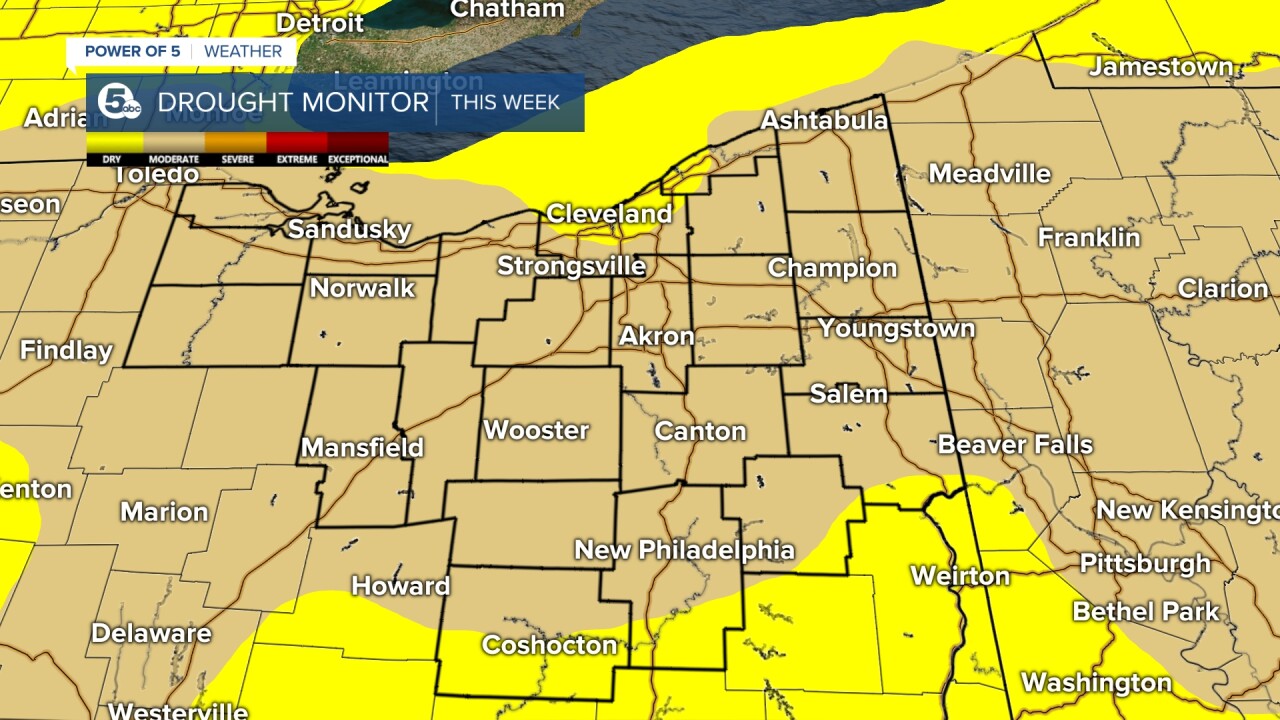
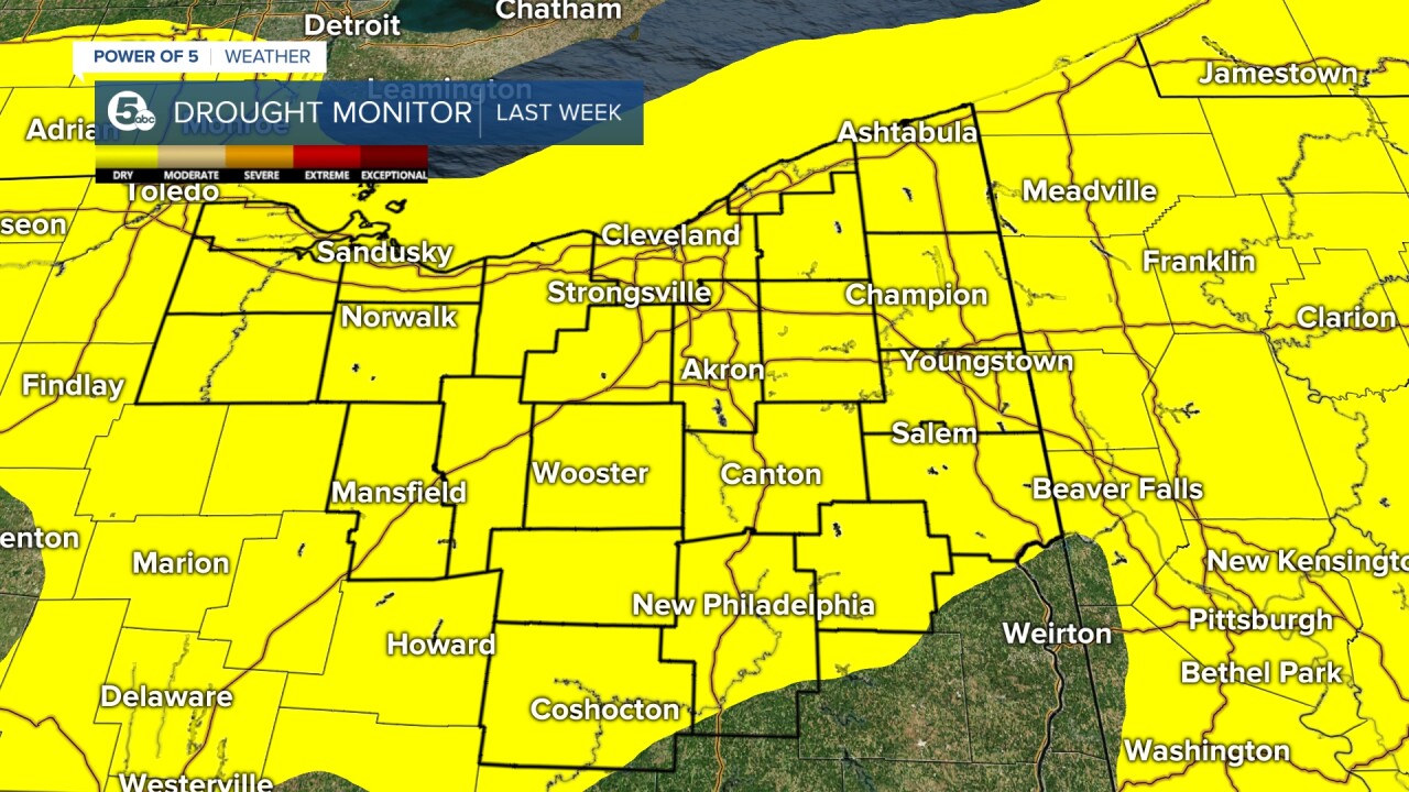
DROUGHT WORSENS: The weekly update to the United States Drought Monitor was issued on Thursday, and there have been noticeable changes across our viewing area over the last week. Compare the map released for the week of June compared to this week below. Note how the yellow area (D0) has been replaced by moderate drought (D1) across much of Northern Ohio. The U.S. Drought Monitor is a map released every Thursday (with data from Tuesday to Tuesday). It tracks drought across the U.S. Using five classifications: Abnormally dry (D0), which shows areas that may be going into or are coming out of drought, and four levels of drought: Moderate (D1), severe (D2), extreme (D3) and exceptional (D4). On June 1, 0% of the entire Buckeye State was experiencing moderate drought. Now that has increased to 62% of the state in moderate drought, and 97% of the state is experiencing abnormally dry conditions.
Additionally, the surplus of precipitation Cleveland has had for much of the year has dwindled to 0.01'' on June 7. That means annual precipitation has become deficient. It is clear we are due for rain across the region, but will we receive any soon?
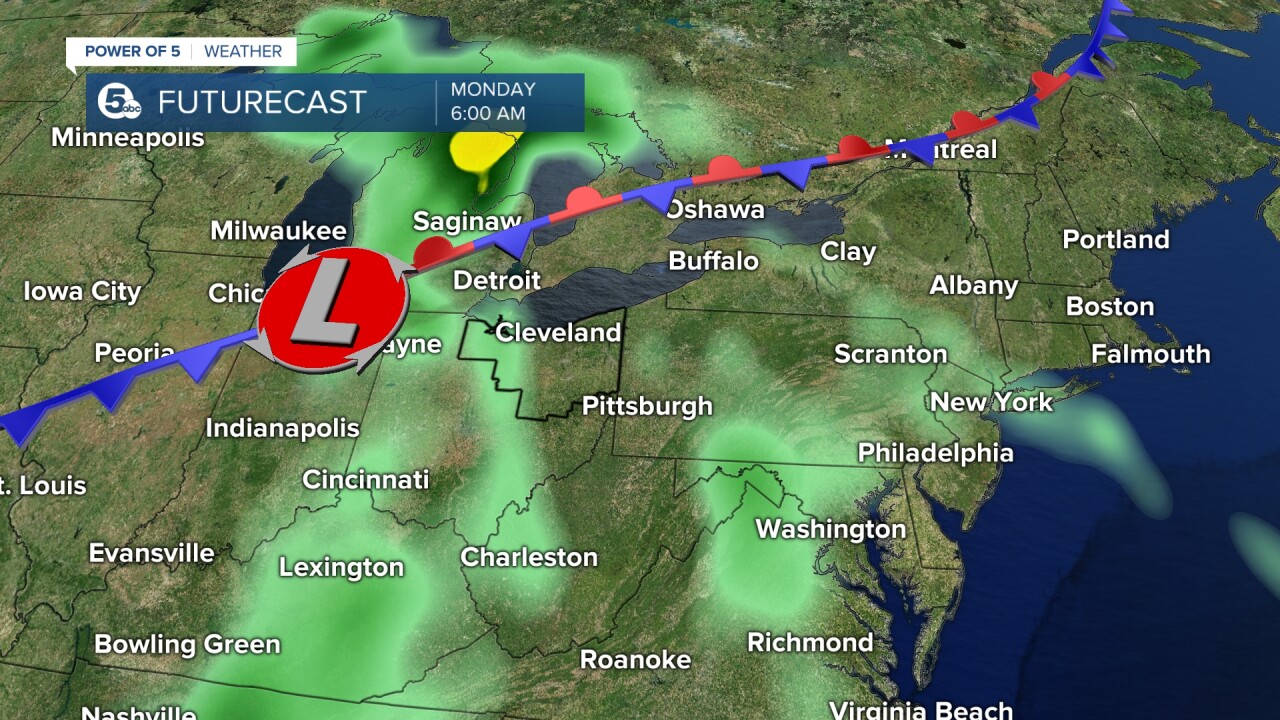
RAIN POTENTIAL: Only isolated light showers are possible in the northeast corner of Ohio on Thursday afternoon and Friday afternoon. Better news — it appears this dry pattern looks to finally break, allowing scattered rain showers to move in late Sunday and early Monday of next week as an area of low pressure that will develop to our west moves east by Sunday night/Monday.
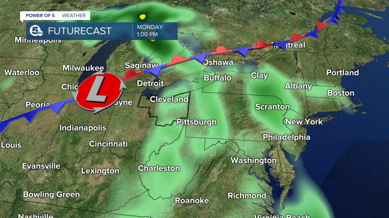
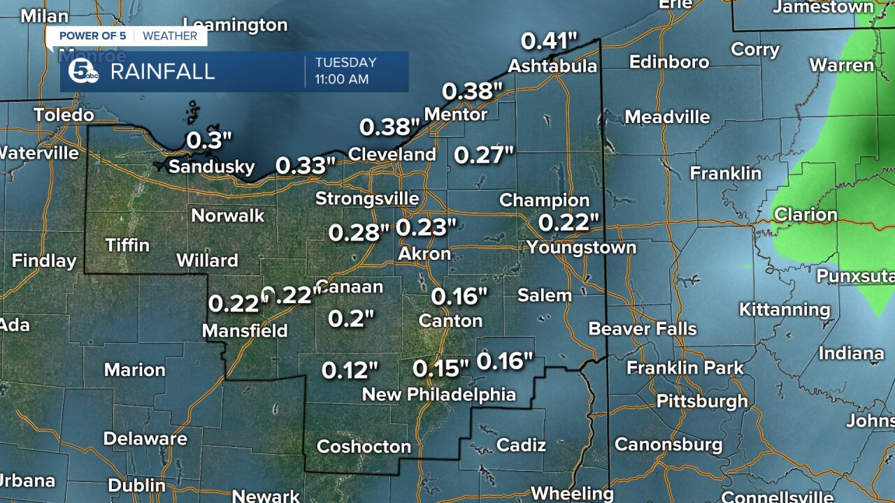
It is still a few days out, but while rain is good news, it does not look like an overwhelming amount. At this time, plan for less than half an inch of rain. Below is a raw model data from the GFS computer. It shows less than a quarter of an inch of rain by Tuesday. However, I will continue to monitor potential rainfall totals and additional rainfall chances over the next several days. Be sure to tune into News 5 for the daily and weekly forecasts. Follow Katie McGraw on Facebook & Twitter.
Want the latest Power of 5 weather team updates wherever you go? Download the News 5 App free now: Apple|Android
Download the StormShield app for weather alerts on your iOS and Android device: Apple|Android
Click here to view our interactive radar.
Read and watch the latest Power of 5 forecast here.
Follow the rest of the News 5 Weather Team:
Mark Johnson: Facebook & Twitter
