


SATURDAY EVENING UPDATE:
It was a soaked start to the day, but we are not done yet. Get ready for more rain. Another 0.5 - 1.5 inches of rain will be possible before the end of the weekend. We could even see some snow on Sunday!
Excessive rainfall could lead to flash flooding as well as flooding of our area rivers, creeks, streams, and other low-lying and flood-prone locations. Flooding may also occur in poor drainage and urban areas. Extensive street flooding and flooding of creeks and rivers are also possible.
In this article, I will discuss the current alerts, including the flood alerts, focus on several river gauges across Northeast Ohio and the potential flooding at each, plus the rain's estimated timeline.

FLOOD WARNINGS are currently in effect for the following rivers/counties:
- Portage River at Woodville in Sandusky County. Minor flooding is ongoing and expected to continue until Monday afternoon. The flood stage is 9 feet. Earlier this morning, it was reported at 8.1 feet. The river is expected to rise to 9.9 feet this morning, briefly fall after midnight, and then rise to 9.5 feet Sunday afternoon. It will fall below flood stage Monday morning.
- Eagle Creek at Phalanx Station in Trumbull County. Minor flooding is occurring and will continue for days. The flood warning will remain in effect until further notice. The water is expected to rise above flood stage this weekend, reaching a crest of 12.2 feet on Sunday morning. The flood stage is 9.5 feet.
- Black River at Elyria in Lorain County. Minor flooding is ongoing and will remain possible until further notice. The flood stage is 9.5 feet. Earlier this morning, it was reported at 6.4 feet. The river is expected to rise to 9.9 feet on Sunday, with additional rises possible after that.
- Stillwater Creek in Tuscarawas County. The flood warning is in effect from Saturday through Wednesday morning. Friday morning, the stage was 7.7 feet. The bankfull stage is 7.6 feet. The river is expected to rise above flood stage early tomorrow afternoon to a crest of 12.8 feet Monday morning. It will then fall below flood stage early Wednesday morning. This crest compares to a previous crest of 12.8 feet on 12/27/1945.
- Muskingum River at Coshocton in Coshocton County. The flood warning is in effect from Saturday night into Tuesday morning. Minor flooding is expected. Friday morning, the stage was 13.3 feet. The bankfull stage is 13.0 feet. The river will rise to 14.6 feet tomorrow morning. It will rise above flood stage early Sunday morning to 16.2 feet early Monday morning. It will then fall below flood stage early Tuesday morning. The flood stage is 15.0 feet. This crest compares to a previous crest of 16.2 feet on 06/02/1980.
- Killbuck Creek near Killbuck, affecting Wayne and Holmes Counties. The warning will be in effect through early Wednesday afternoon. Expect minor flooding. The flood stage is 15 feet. Earlier this morning, it was reported at 14.6 feet. The river is expected to rise to 16.6 by Saturday night and will fall below the fall stage Wednesday.
- Tuscarawas River above New Philadelphia. The warning will be in effect through Sunday morning. Expect minor flooding. The flood stage is 7.5 feet. Earlier this morning, it was reported at 7 feet. The river is expected to rise to 7.6 by Saturday evening and will fall below the fall stage late tonight.
- Black Fork Mohican River near Loudonville. The river stage at the Black Fork Mohican River at Loudonville was 10.3 feet and rising. Flood stage is 10.0 feet. - The river will crest between 10.5 feet and 11.0 feet just after midnight tonight before falling below flood stage late Sunday afternoon.
FLOOD ADVISORIES have also been issued across several counties through the late evening.
- Ashland
- Richland
- Stark
- Holmes
- Wayne
Widespread heavy rain and storms last night dropped 1 to 2 inches of rain, and minor flooding is either ongoing or imminent. Additional rainfall amounts of 0.5 to 1.5 inches are expected over the area. This additional rain will result in minor flooding.
A FLOOD WATCH remains in effect until 8 a.m. Sunday for the following counties:
- Erie
- Huron
- Lorain
- Richland
- Cuyahoga
- Holmes
- Medina
- Stark
- Summit
- Wayne

KNOW THE LINGO:
Action, Minor, Moderate, Major - what do they all mean when discussing river flooding?
- ACTION STAGE: Be cautious. Action is taken for possible high water. Water may cause minor impacts and be a nuisance to persons near the stream. Local governments or agencies may take action to reduce property damage and danger to life.
- MINOR FLOOD STAGE: Take action! Some property flooding and public threats may occur. Roadways, trails, parkland, and private property near the stream may become flooded.
- MODERATE FLOOD STAGE: Take action! Flooding of structures and main roadways may occur. Residences and numerous roadways near the stream may become flooded. Evacuations may be necessary. Disruptions to daily life.
- MAJOR FLOOD STAGE: Take action! Extensive flooding of structures, main roadways, and other critical infrastructure may occur. Schools, hospitals, police stations, fire stations, residences, businesses, and roadways may become flooded. Evacuations may be necessary. Significant disruptions to daily life.

RIVER FORECAST: The Power of 5 Weather Team monitors several rivers and creeks across Northeast Ohio. Below is the forecast for several river gauges across NEO using data from the National Water Prediction Service/NOAA.
Cuyahoga River at Independence in Cuyahoga County
- Flood Stage: 17 feet
- Forecast: Minor Flooding to a crest of 17.10 feet
- Expected to fall on Monday.
Cuyahoga River at Old Portage in Summit County
- Flood Stage: 10.5 feet
- Forecast: Action Stage at 9.2 feet.
- The water is expected to fall late Sunday/early Monday
Black River at Elyria in Lorain County
- Flood Stage: 9.5 feet
- Minor flooding is ongoing after reaching a crest of 11.39 feet on Friday
- Forecast: Minor flooding returns this weekend at 10.2 feet.
- The water is expected to fall slowly early next week.
Vermilion River near Mill Hollow in Lorain County:
- Flood stage: 9 feet
- Forecast: Near action Stage at 6.8 feet.
- The water is expected to fall quickly on Monday.
Huron River at Milan in Erie County:
- Flood Stage: 18 feet
- The river has fallen rapidly in the last day.
- Forecast: Flooding returns this weekend at 16 feet. This is in the action stage.
- The water is expected to fall quickly early next week.
Sandusky River at Tiffin in Seneca County:
- Flood Stage: 9 feet
- The river is in the action stage on Friday.
- Forecast: Minor flooding is expected this weekend at 9.5 feet. This will be very close to moderate flooding.
- Flooding will continue to be possible early next week, although slowly decreasing.
Portage River at Woodville in Sandusky County:
- Flood Stage: 9 feet
- Minor flooding is ongoing after reaching a crest of 11.82 feet on Friday and is expected to continue this weekend.
- Forecast: Minor flooding continues this weekend between 9 and 12 feet.
- The water is expected to fall slowly next week but the water is expected to remain high through midweek.
Killbuck Creek at Killbuck in Holmes County:
- Flood Stage: 15 feet
- Minor flooding is ongoing after reaching a crest of 15.30 feet Saturday morning.
- Forecast: Minor flooding continues this weekend at 16.6 feet. This will be very close to moderate flooding.
- Minor flooding will continue until further notice.
Muskingum River below Coshocton in Coshocton County:
- Flood Stage: 15 feet
- Water has risen over the last day and will continue to climb over this weekend.
- Forecast: Minor flooding is expected this weekend at 15.70 feet.
- The water is expected to fall slowly next week.
Tuscarawas River at Newcomertown in Tuscarawas County:
- Flood Stage: 11 feet
- No flooding is currently ongoing, but the river is expected to rise this weekend.
- Forecast: The river is expected to rise into the action stage at 9.70 feet.
- The water is expected to fall slowly next week.
Tuscarawas River at Massillon in Stark County:
- Flood Stage: 18 feet
- The water has quickly risen this morning
- Forecast: The river is expected to keep rising to 17.80 feet in the action stage. This will be near minor flooding.
- The water is expected to fall slowly next week.
Tuscarawas River at New Philadelphia in Tuscarawas County:
- Flood Stage: 7.5 feet,
- Forecast: Rising water and in the action stage.
- Forecast: The river is expected to keep rising to 7.6 feet, causing minor flooding.
- The water is expected to fall slowly early next week but remain in the action stage.
Stillwater Creek at Uhrichsville in Tuscarawas County:
- Flood Stage: 10 feet
- Flooding is ongoing. Water will continue to rise this weekend
- Forecast: Minor to near-moderate flooding is expected by Monday/early Tuesday at 12.9 feet
- The water is expected to fall slowly early next week but will remain high for days.
Nimishillen Creek in Stark County (North Industry):
- Flood Stage: 10 feet
- Minor Flooding is ongoing
- Forecast: Minor flooding will continue Saturday but will drop quickly from 10.41 feet to 7.3 feet by Saturday night.
Eagle Creek at Phalanx Station in Trumbull County:
- Flood Stage: 9.5 feet
- Minor flooding is ongoing and will continue into the weekend
- Forecast: Minor flooding at 12.13 feet by Monday but will remain high into next week.
Grand River at Painesville in Lake County:
- Flood Stage: 12.5 feet
- Forecast: The river will rise again this weekend to 8.20 feet.
- The water is expected to fall by early next week.

RAINFALL TIMELINE: The short and sweet - plan for a soaked weekend.
Widespread showers returned this evening with another surge of moisture and moderate to heavy rain tonight.
Wet weather will linger for much of Sunday as well, although it will not be as heavy but certainly noticeable. Another 0.5 - 1.5 inches will be possible through Sunday.
Temperatures will be falling this weekend. It will be briefly mild in the 60s for everyone Saturday morning and early afternoon. However, cooler air will be sinking south from the NW to the SE throughout the day. Temperatures will likely drop 10 degrees or more in an hour! It will stay mild the longest the more south and east you live.
Overnight temperatures will be in the 40s - that is our Sunday high temperature because the digits continue to drop on Sunday, with afternoon temperatures in the 30s. With lingering showers, rain will likely change to wet snow. Minor wet/slushy accumulation will be possible!
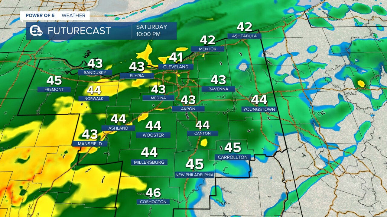
Scroll through the images of Futurecast to get an idea about the timing and coverage of rain over the next few days.


Saturday afternoon, high water impacted the shoulder of the roadway, according to the Ohio Department of Transportation.
Crews went out and finished repairs to the shoulder of the road. The roadway remains open:


More Viewer Photos:


Want the latest Power of 5 weather team updates wherever you go? Download the News 5 App free now: Apple|Android
Download the StormShield app for weather alerts on your iOS and Android device: Apple|Android
Click here to view our interactive radar.
Read and watch the latest Power of 5 forecast here.
Follow the News 5 Weather Team:
Mark Johnson: Facebook & Twitter
Trent Magill: Facebook & Twitter
