WAYNE COUNTY, Ohio — The National Weather Service confirmed an EF-1 tornado touched down in Wayne and Holmes counties Wednesday night.
The survey team found evidence of an EF-1 tornado with maximum wind speeds of 105 mph near Shreve, Ohio in Wayne and Holmes County (near the county line). The tornado was on the ground for 2.24 miles from 8:55 pm until 8:59 pm with a max width path of 100 yards.
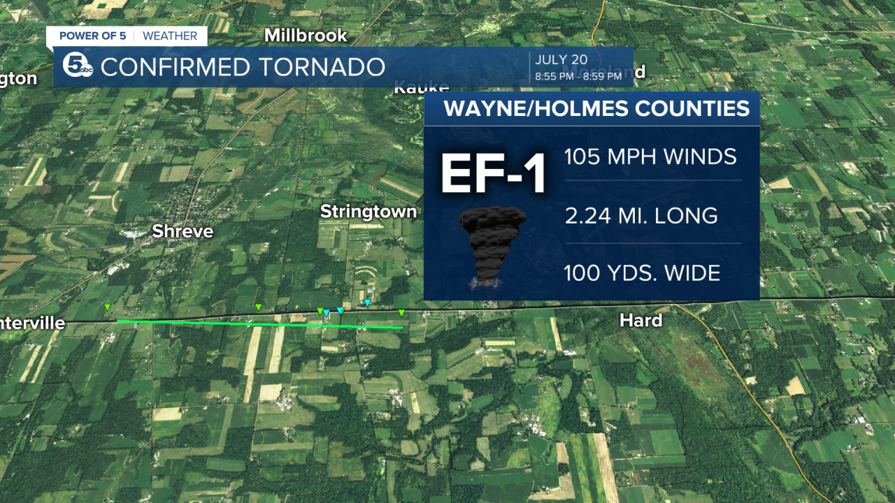
The National Weather Service said it started south-southwest of Shreve and 400 feet north of Centerville road and destroyed a barn. The tornado continue east-southeast heading along Centerville Road and destroyed another barn, damaged roofs of two additional barns and a storage shelter. Plus, many trees were snapped and uprooted. No fatalities or injuries were reported.
News 5 crews were able to see the severe damage to at least one house and one barn on the border of Wayne and Holmes counties left by the tornado. Another nearby building was also hit.

A barn in the 10500 block of County Road 1 on the border of Wayne and Holmes counties was demolished by the storm. The house sustained heavy roof damage.

According to the homeowner, they are the sixth generation of the family that has lived in the house on the property, which dates back to 1875.

The barn held almost 150 years of family memories, said the homeowner.
The County Line Greenhouse next door also lost a major part of its roof.

The damage was caused by a confirmed tornado in Shreve.
AirTracker5 captured some of the damage:
For reference, the EF Scale classifies tornadoes into the following categories:
- EF0 — weak — 65 to 85 mph...WEAK......65 TO 85 MPH
- EF1 — weak — 86 TO 110 mph
- EF2 — strong —111 TO 135 mph
- EF3 — strong — 136 TO 165 mph
- EF4. — violent — 166 TO 200 mph
- EF5 — violent — >200 mph
Want the latest Power of 5 weather team updates wherever you go? Download the News 5 App free now: Apple|Android
Download the StormShield app for weather alerts on your iOS and Android device: Apple|Android
Click here to view our interactive radar.
Read and watch the latest Power of 5 forecast here.
Follow the News 5 Weather Team:
Mark Johnson: Facebook & Twitter
Remeisha Shade: Facebook & Twitter


