


This weekend is the unofficial end of summer! Over the next four days, we will experience a variety of weather, including high heat and humidity, sunshine, strong storms, and a big cool-down. Let's break down what to expect for each day below.
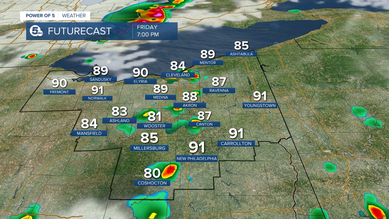
FRIDAY will start dry and sunny. It will be another hot one, with temperatures climbing back into the 90s for many communities across Northeast Ohio as a warm front lifts through the area. It will also be humid as well - making it feel even hotter.
While we start the day off dry, sporadic thunderstorms are expected to develop ahead of a cold front. These look to hold off until the late afternoon or even into the evening. This will be widely scattered to start, so not everyone is guaranteed to see rain on Friday.
Rain chances will continue to increase into Friday night and Saturday morning.

SATURDAY will start with scattered showers and storms. The *best* chance for rainy and stormy weather will be the opposite of Friday. The highest storm chance will be during the first half of the day, with a slow drying trend by Sunday.
Note the graphic below, which shows there is still quite a bit of rain and a few storms by 2 p.m. on Saturday. Keep this in mind for any plans you have on Saturday.
It will not be as hot as Friday, with temperatures in the upper 70s to mid-80s, but it will still feel humid.


A few storms, both on Friday and Saturday, could become strong or severe. This is a low chance for isolated storms to become big and tall and bring the threat of damaging winds, heavy
rain, and lightning.
While the threat looks low, it is never zero. The Power of 5 Weather Team will be watching the radar and will keep you aware if any storms do become severe. Remember that any storm is dangerous due to lightning. This is why we always say, "When thunder roars, get indoors!''


SUNDAY will be much drier, with cooler temperatures and falling humidity. It looks like we could start the day off on a muggy note, but that will improve throughout the day as a secondary cold front slides through NEO. This front and change of airmass look pretty dry, but there is a small chance for a few showers on Sunday, especially in our north and eastern communities.
LABOR DAY looks great but will be well below average in the temperature department. From Friday to Monday, the temperatures will drop about 20 degrees. It will also be dry and not humid—perfect for getting outside for any holiday events you may have. Enjoy!
I hope you have a great and safe holiday weekend. I will be sure to update this article as needed, so be sure to check back for any changes.

Want the latest Power of 5 weather team updates wherever you go? Download the News 5 App free now: Apple|Android
Download the StormShield app for weather alerts on your iOS and Android device: Apple|Android
Click here to view our interactive radar.
Read and watch the latest Power of 5 forecast here.
Follow the News 5 Weather Team:
Mark Johnson: Facebook & Twitter
Trent Magill: Facebook & Twitter
