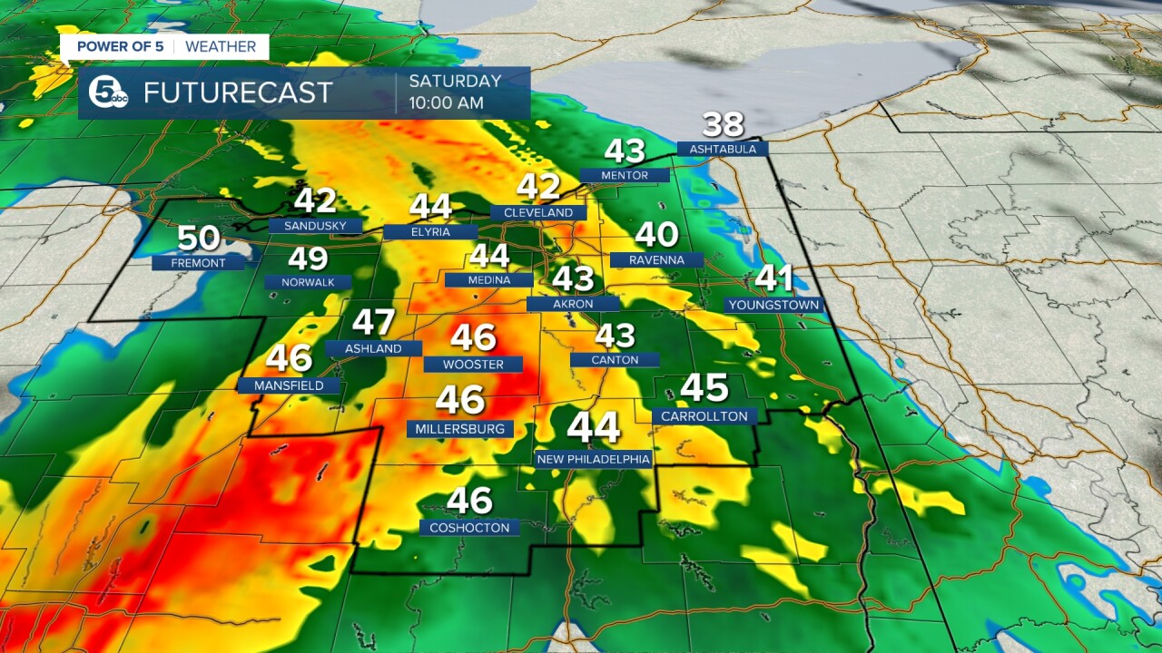
It does not rain all weekend, but it will not be completely dry either. High pressure remains in control for today and will keep us dry, but a low-pressure system out to our west is en route and will bring the return of rain by Saturday. Let's discuss timing and potential impacts on your holiday weekend day by day below!

SATURDAY: A weak area of low pressure will ride along the front and eventually drag a cold front through late on Saturday, so the warm-up is brief. It will be about 10 degrees cooler by Easter. The best chance for rain and the most widespread rain will be Saturday morning. HOWEVER, the rain chance is not 0% during the afternoon, but it becomes more scattered in nature (hit or miss). That means if you have an afternoon event, like an Easter Egg Hunt on Saturday, plan for damp conditions.
A few rumbles of thunder will be possible Saturday afternoon. It appears it will be warmer in our south and western communities. Plan for 40s farther north and closer to 60 degrees in central Ohio. There is a slight chance for strong or severe storms due to the potential for large hail. This looks more likely closer to Columbus. It also looks to be a brief window this could occur (roughly 3 to 7 p.m.). Showers will gradually fade by Saturday evening.


Scroll through the images of Futurecast to get an idea about the timing and coverage for rain on Saturday.


SUNDAY: Easter will start off dry, but clouds look to hang tough. As previously mentioned, high temperatures will drop by about ten degrees from Saturday to Sunday following the passage of a cold front. There will be plenty of dry time, though, during the DAY. Rain chances will creep back up by Sunday evening and continue into Monday. Scroll through the images of Futurecast to get an idea about the timing and coverage for rain on Sunday.

While this article focuses on the holiday weekend, I also want to prepare readers for next week, which looks active. Rounds of rain are expected for nearly the entire work week. This repeated rainfall could lead to flooding concerns, especially from Monday into Tuesday. Stay tuned to The Power of 5 Weather Team on-air and online for the latest information.


Want the latest Power of 5 weather team updates wherever you go? Download the News 5 App free now: Apple|Android
Download the StormShield app for weather alerts on your iOS and Android device: Apple|Android
Click here to view our interactive radar.
Read and watch the latest Power of 5 forecast here.
Follow the News 5 Weather Team:
Mark Johnson: Facebook & Twitter
Trent Magill: Facebook & Twitter


