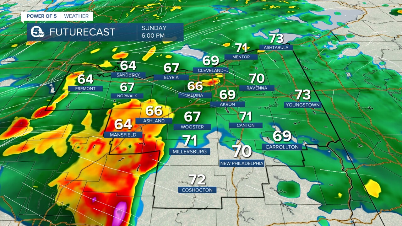
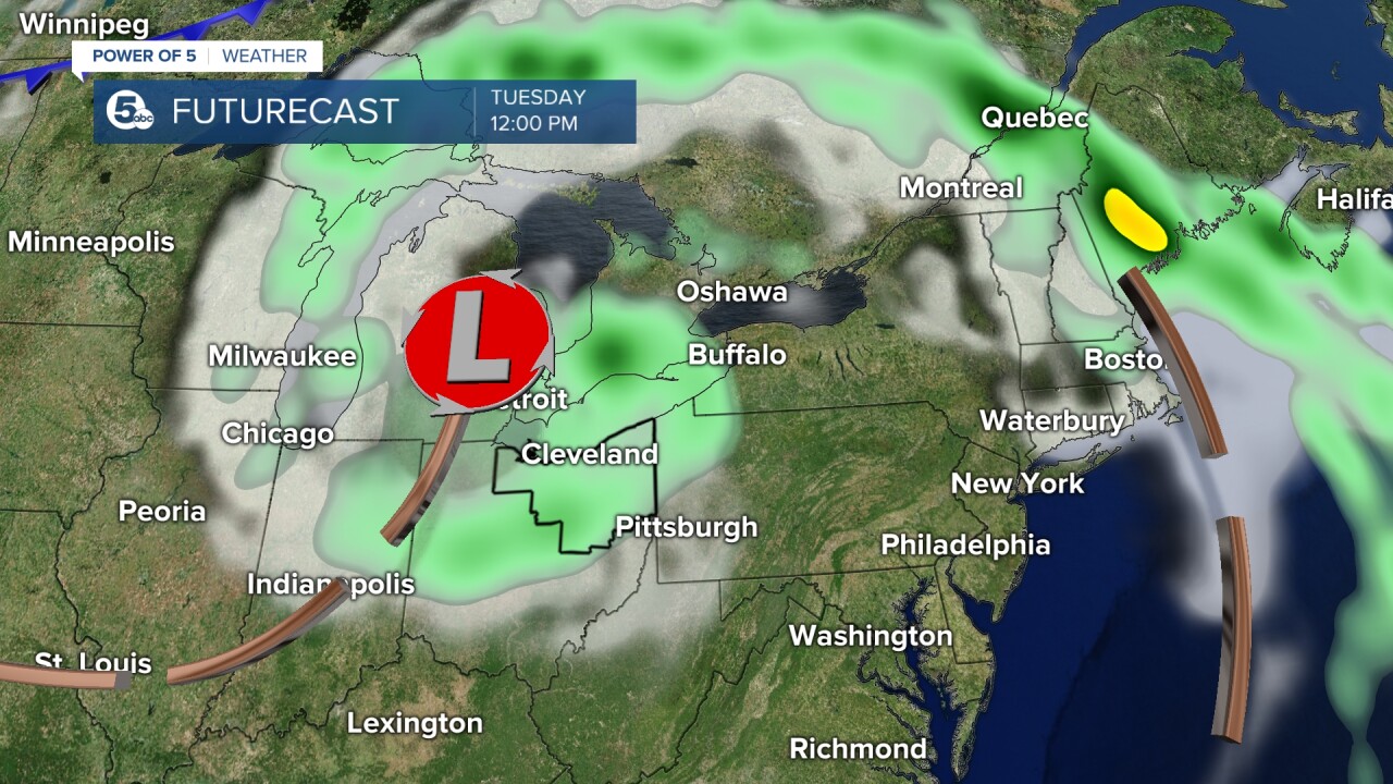
A moderate drought has developed across Northeast Ohio after three weeks of no rain in many communities. We are in of rain and the pattern flips on Sunday. Rain will become widespread as low pressure out west slides over the Buckeye State and drags a cold front through Sunday night and Monday. It is great news to get some rain, but it could be too much rain too fast for some communities. Let's discuss timing and totals.
WHEN DOES RAIN ARRIVE? We are all still dry right now, but throughout the afternoon rain is going to increase from the south and west and spread to the north and east. Rain looks to become widespread by the late afternoon/early evening. Rain could also be heavy at times! pic.twitter.com/FegZwCu2k3
— Katie McGraw (@KatieMcGrawx) June 11, 2023
TIMING: Plan for increased clouds and warm temperatures to start the day. It will be dry throughout the morning, with rain moving into our western and southern communities first. Rain will increase throughout the afternoon. Rain should become widespread by the late afternoon/early evening with pockets of heavy rainfall. Rain will continue into early Monday. After a brief lull in the rain Monday afternoon, the low pressure will spin around the Great Lakes and bring another round of rain by Tuesday. Scroll through the images of Futurecast to get an idea about the timing & coverage of the rain Sunday and Monday.


TOTALS: While we are in need of rain, we do not want to receive too much rain too fast. That is a possibility for some communities on Sunday. Most totals will range from 0.50 inches to 2.00 inches, but locally higher amounts over 2 inches will be possible for some. As of Sunday morning, it appears the axis of heaviest rainfall will be west of Cleveland to about Sandusky and extends south into Mansfield. Due to the lack of rain, the ground is very hard & dry. Heavy/intense rain rates make it more difficult for the rain to be absorbed by the soil/ground and runoff occurs. This means isolated flooding and ponding will be possible. We will be monitoring the flood threat all day tomorrow. Severe weather is more likely well to the south of our viewing area. Be sure to check back for the latest information and tune into News 5 Sunday morning, evening and night for updates.

Want the latest Power of 5 weather team updates wherever you go? Download the News 5 App free now: Apple|Android
Download the StormShield app for weather alerts on your iOS and Android device: Apple|Android
Click here to view our interactive radar.
Read and watch the latest Power of 5 forecast here.
Follow the News 5 Weather Team:
Mark Johnson: Facebook & Twitter
Trent Magill: Facebook & Twitter


