CLEVELAND — December was great as it was warmer than normal temps and there was a good amount of sunshine. We knew we'd have to pay for it eventually... right? Of course, we did. And of course, we are.
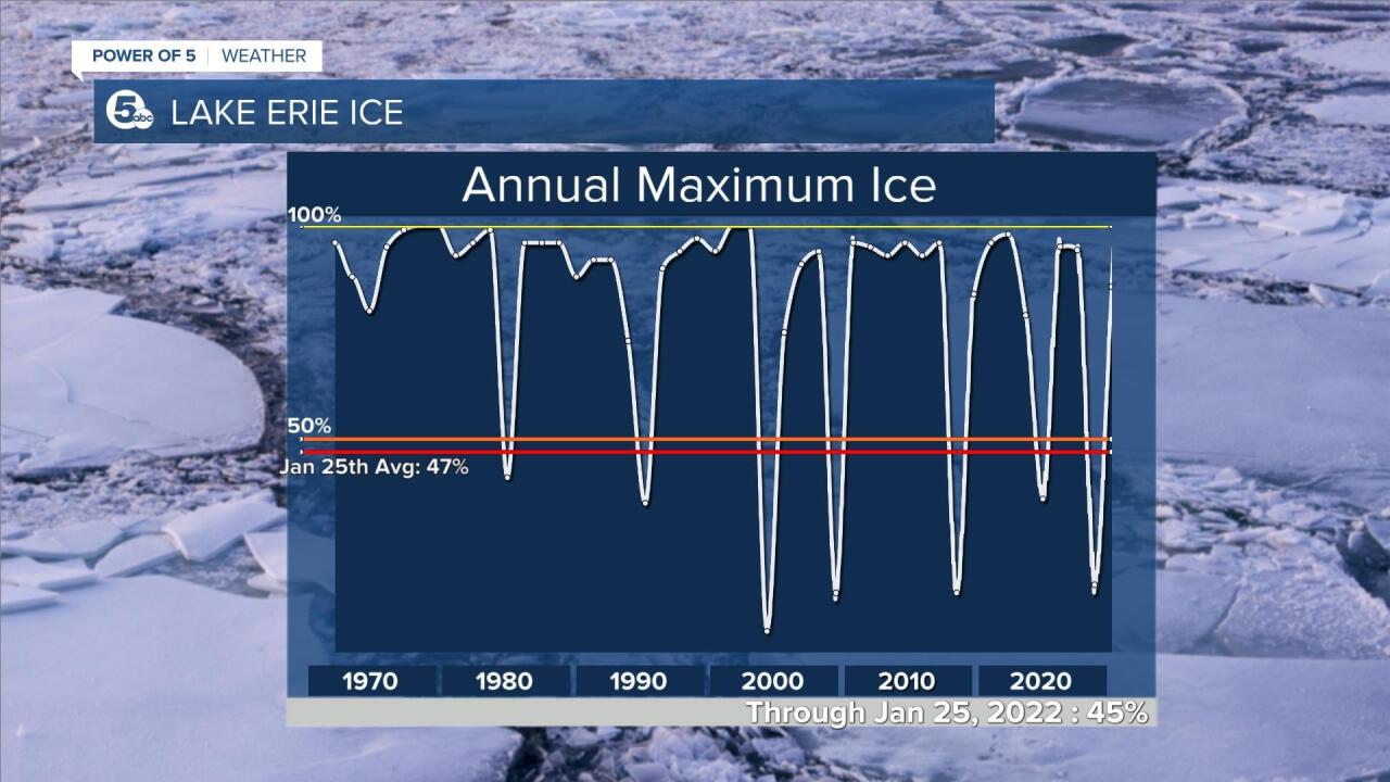
One of the biggest indicators of "how winter is going" is the ice on Lake Erie. We had quite the delay but are recovering quickly. Back near average in just a couple of weeks with more cold on the way.

Whether or not we hit the yearly average maximum ice coverage is still to be determined but we're well on our way.
Our yearly maximum ice coverage averages about 83%. We're over halfway there already.
So what does it mean? As more of the lake freezes over, the less Lake Effect snow we will receive.

That being said, getting out on the ice is never completely safe. Any shift in wind can shift the ice shelf. We see it every year.

Rescues are extremely difficult so be safe and prepare for anything if you're venturing out.
RELATED: Temperatures drop into single digits and wind chills below zero Wednesday night
Want the latest Power of 5 weather team updates wherever you go? Download the News 5 App free now: Apple|Android
Download the StormShield app for weather alerts on your iOS and Android device: Apple|Android
Click here to view our interactive radar.
Read and watch the latest Power of 5 forecast here.
Follow the News 5 Weather Team:
Mark Johnson: Facebook & Twitter
Remeisha Shade: Facebook & Twitter


