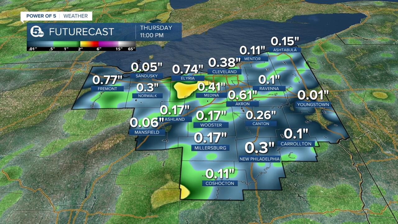
SUMMARY: Showers and thunderstorms are returning to the area on Thursday. These storms may produce localized flash flooding into Thursday night.

SET UP: Wednesday was a SCORCHER. Hot, humid and gusty! Heat and humidity help fuel storm development. Additionally, a cold front to our north and west slid toward the area last night, increasing storm potential. That front never completely slides through Ohio so our storm threat will linger for days. In fact, We don't get in on the cooler, more refreshing air behind the front until Tuesday or Wednesday of NEXT week.

TIMING: Showers and a few storms increase Thursday morning and into Thursday afternoon/evening. While the coverage will be greater, it is not a guarantee to see rain or storms. A few spots may miss out on any storms (or see very little activity), and other locations could be hit with repeated rounds of rain and storms, resulting in hefty rainfall totals and flooding. Some spots could get 2" of rain today and another 1" or more Friday. That means flood prone areas will need to be monitored closely.

SEVERE POTENTIAL: Widespread severe weather is not likely, but there could be a couple strong or severe storms across Northeast Ohio late Thursday afternoon and into the evening. The best shot for isolated damage will be across the southern half of the News 5 viewing area. Besides heavy rain there, isolated damaging wind gusts will also be possible with frequent lightning. The greater concern is repeated rounds of heavy rain that could lead to flash flooding. The Power of 5 Weather Team will keep you posted on the latest updates. Plus, we will alert you if/when any watches or warnings are issued.

Want the latest Power of 5 weather team updates wherever you go? Download the News 5 App free now: Apple|Android
Download the StormShield app for weather alerts on your iOS and Android device: Apple|Android
Click here to view our interactive radar.
Read and watch the latest Power of 5 forecast here.
Follow the News 5 Weather Team:
Mark Johnson: Facebook & Twitter
Trent Magill: Facebook & Twitter


