It has been very dry in Northeast Ohio and Cleveland for more than a week. In fact, it has not rained in 9 days. The last time Cleveland picked up any precipitation was on April 5. That looks to change this weekend. A weak disturbance will impact the area today and a stronger low-pressure system out west moves through tomorrow.
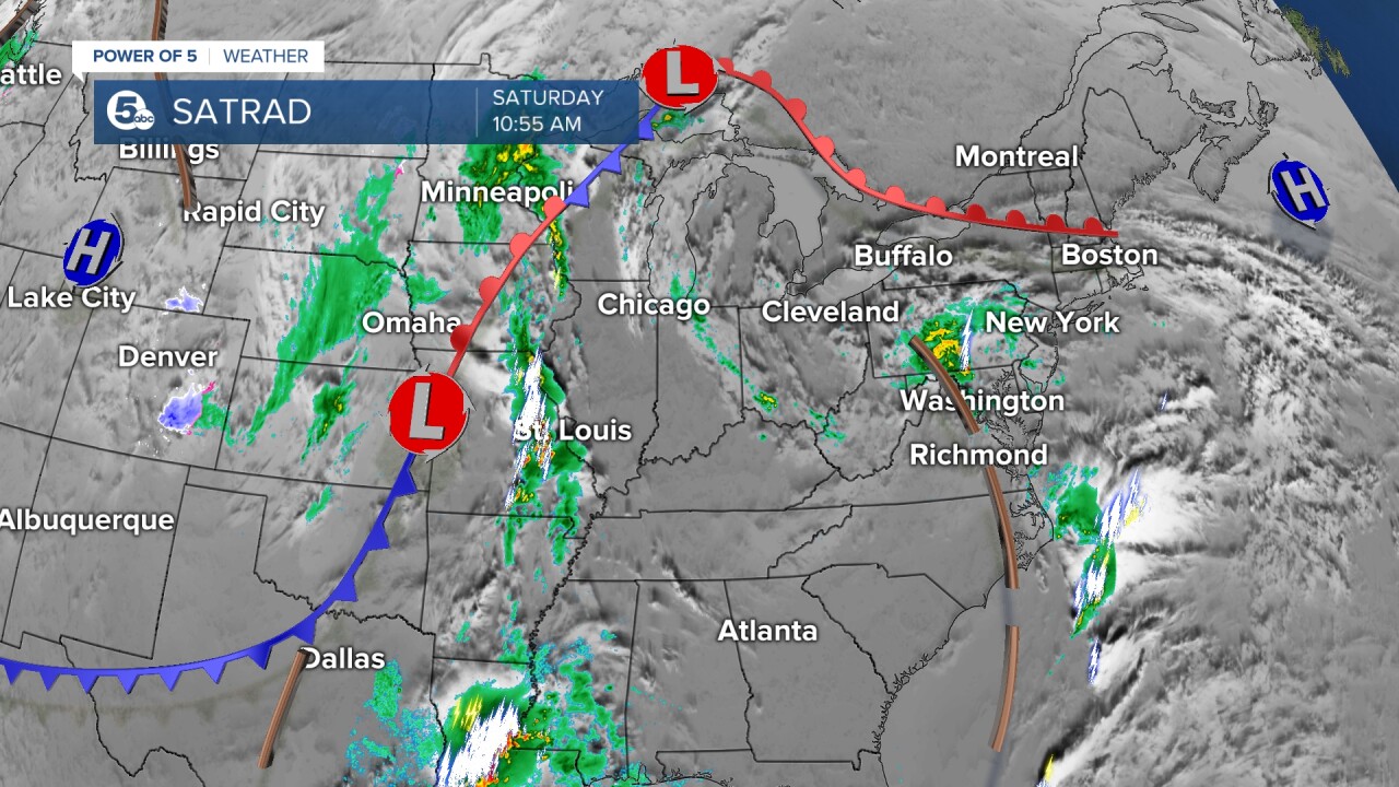
TIMING:
Saturday's rain/storm chance is pretty low - plan for a few spotty showers and isolated thunderstorms during the afternoon/evening on Saturday. These will be hit-or-miss showers and storms though, so not a guarantee for anyone to see any activity. In fact, there is a better chance to stay dry. Any storms will fade around sunset, but temperatures will remain mild this evening and overnight.
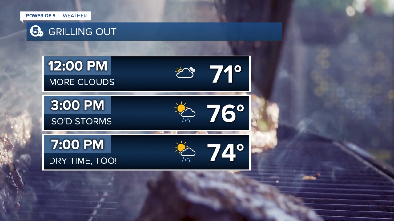
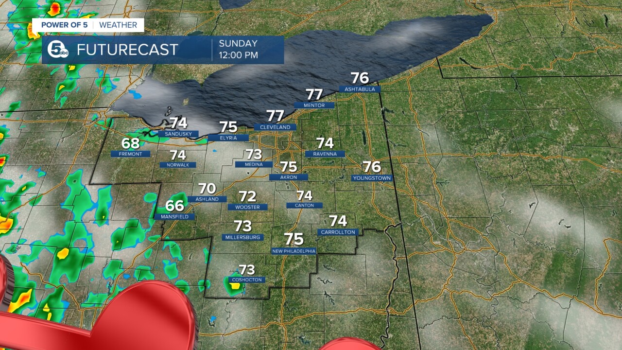
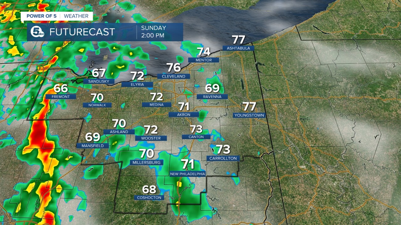
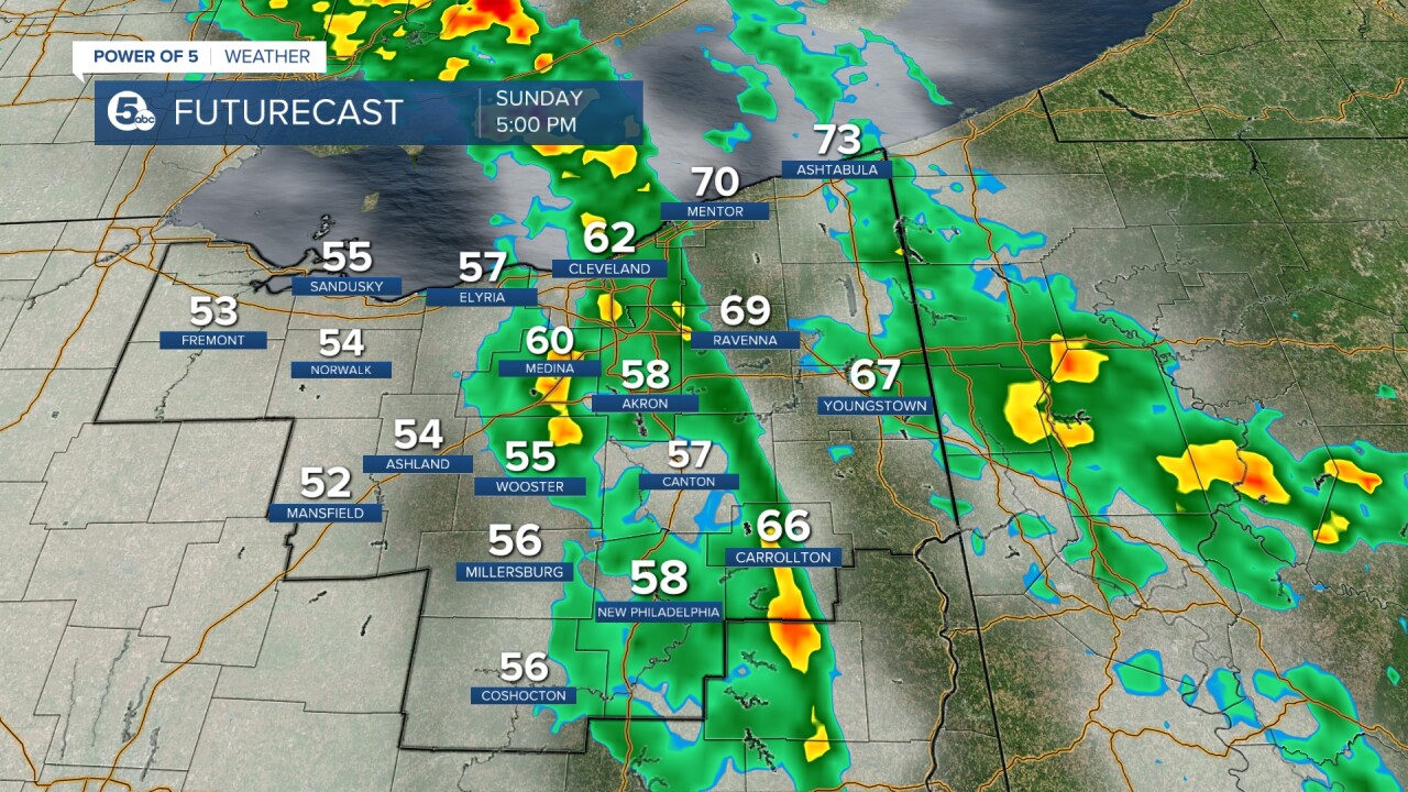
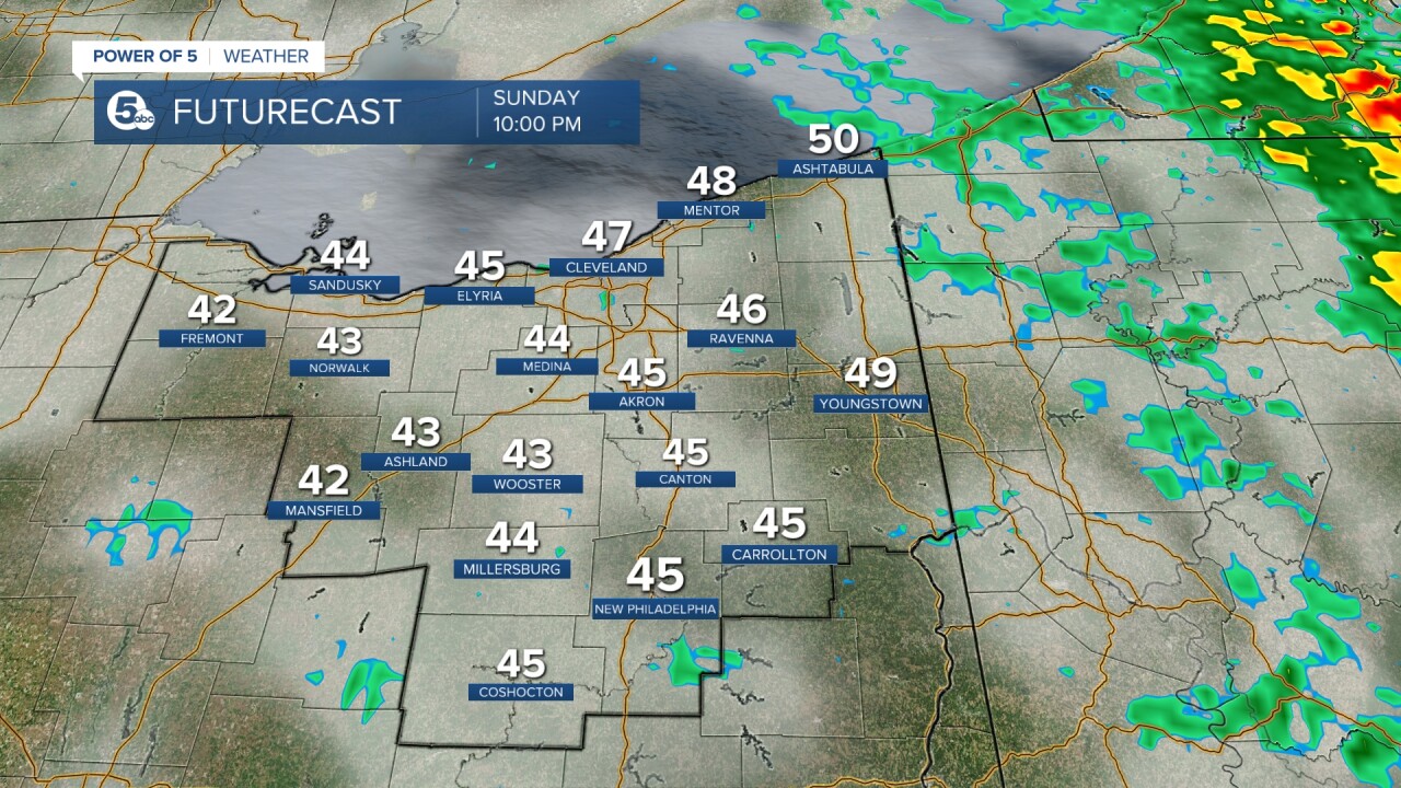
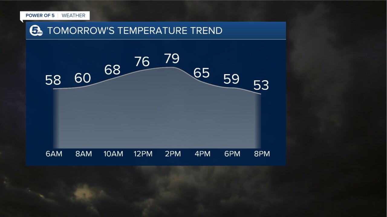
There is a much better chance of storms on Sunday, but it does not storm all day. We will actually start the day off dry, sunny and warm. Temps will quickly rise ahead of the cold front. Storms will start in our western communities in the early afternoon and spread east throughout the day. The best chance for storms will be from about 3 to 6 p.m. However, if you live farther to the west that will start around 1 to 2 p.m. and if you live to the east you can plan for storms to exit by 9 p.m. Scroll through the images of Futurecast to get an idea about timing and coverage of storms tomorrow.
SEVERE POTENTIAL:
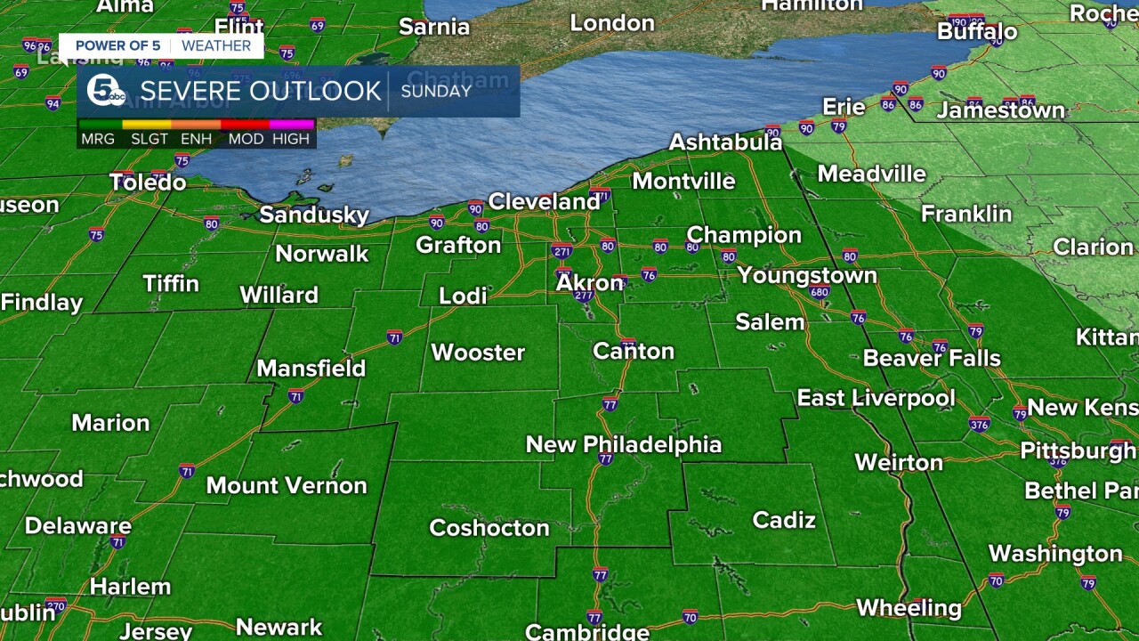
There is a chance a few storms could become strong or severe during Sunday afternoon. The Storm Prediction Center has posted a severe weather risk for the entire viewing area for tomorrow. This area in green is known as a marginal risk for severe weather. That is a level 1 out of 5 and means isolated storms could briefly become severe with limited organization. It is not an overwhelming threat for severe storms. We will certainly have enough heat with morning temperatures well into the 70s. Moisture (dew points) is also increasing over the next day. Increasing heat + increasing moisture = higher instability. With that said, tomorrow's instability and wind energy (wind shear) aloft look to be fairly modest. This means that, yes, severe storms are possible, but it does not look to be widespread damaging storms across the area.
The main threat will be damaging straight-line winds. Small hail and briefly heavy rain will be likely as well. The tornado threat is low, but never zero. Have a plan during the afternoon in case storms do become severe. News 5 will continue to monitor the threat of severe storms this weekend and post updates as needed.
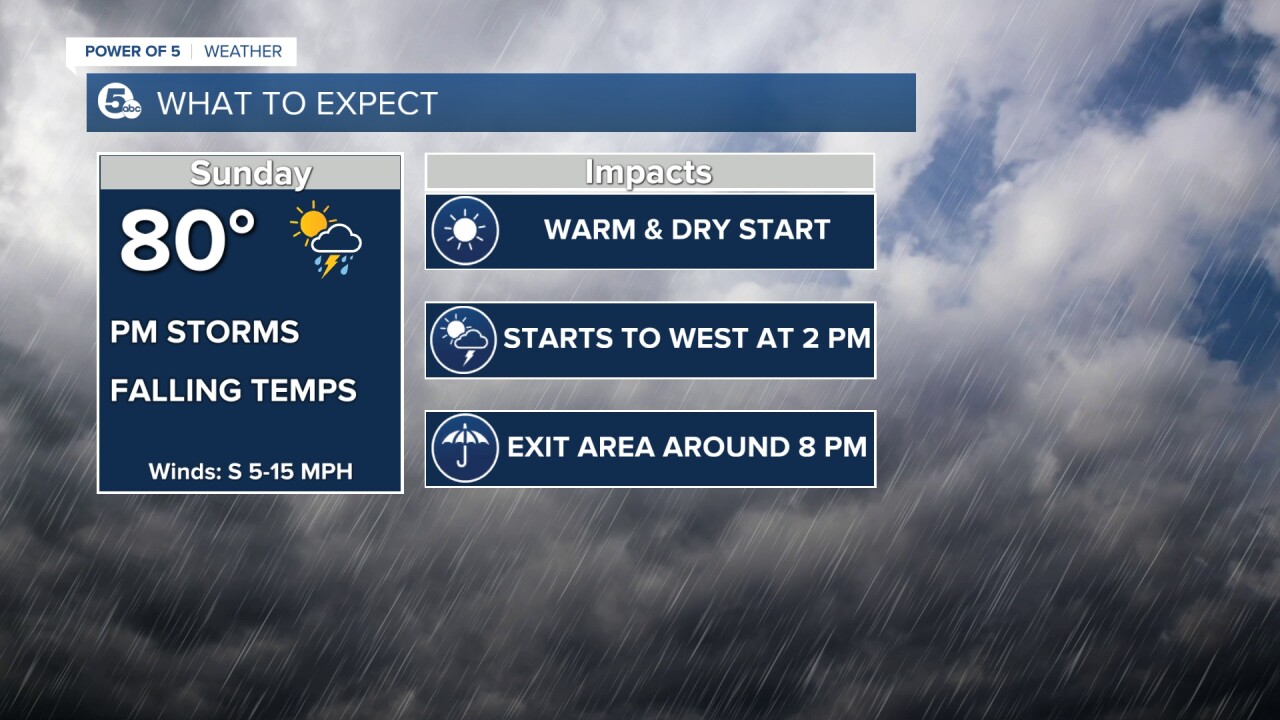
Wind will be increasing tomorrow and into Monday and temperatures will be decreasing. It will be a shock to the system on Monday with much colder temps and blustery winds (making it feel even colder). This low pressure system will linger until Tuesday, keeping damp conditions in the forecast. With much colder temperatures, a few snow showers are not off the table. Minor accumulation will be possible Monday and early Tuesday, but this would be mainly on the grass, your car and back deck. The ground should hold up since temperatures have been so warm. It looks like the chill will not last too long either, we will be warmer again by mid-week.
Want the latest Power of 5 weather team updates wherever you go? Download the News 5 App free now: Apple|Android
Download the StormShield app for weather alerts on your iOS and Android device: Apple|Android
Click here to view our interactive radar.
Read and watch the latest Power of 5 forecast here.
Follow the News 5 Weather Team:
Mark Johnson: Facebook & Twitter
Trent Magill: Facebook & Twitter


