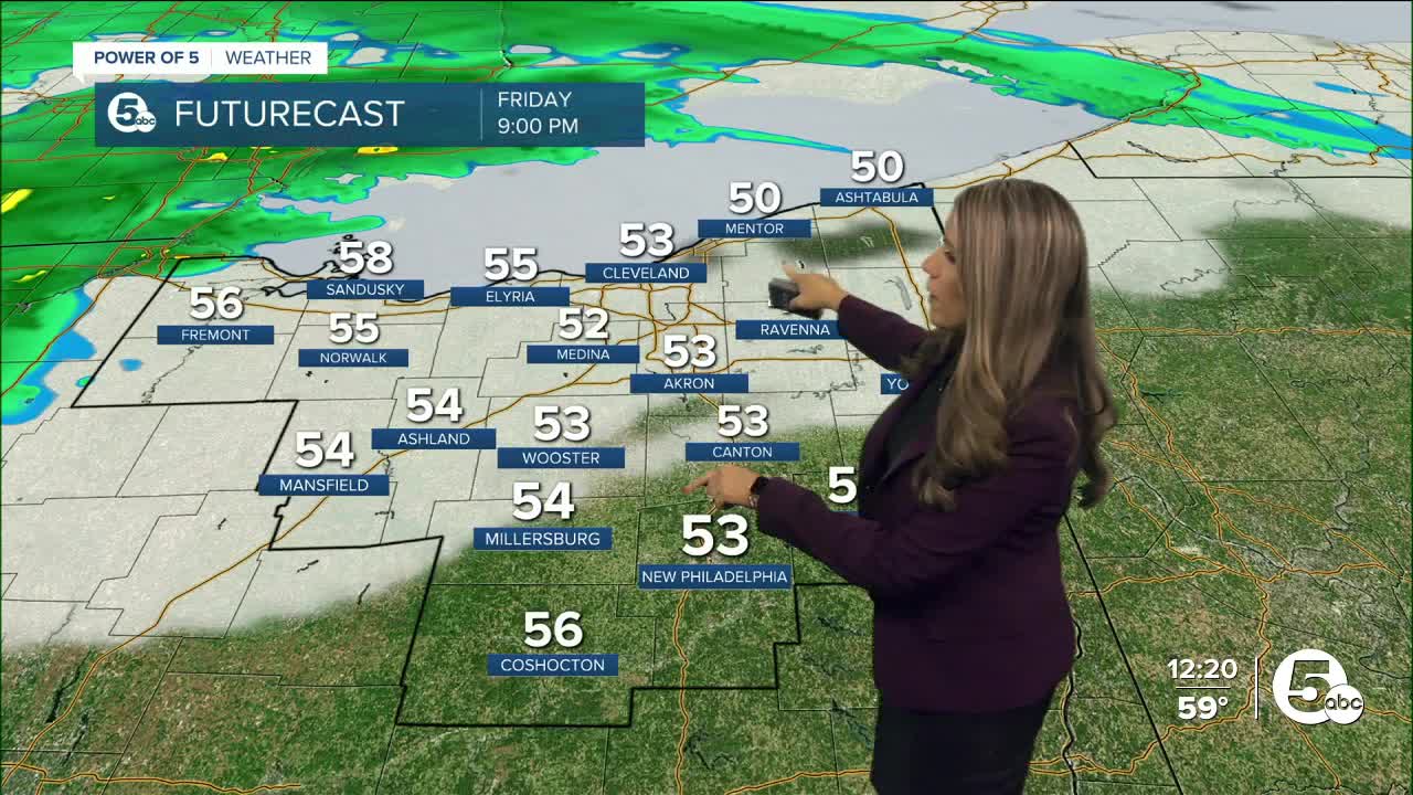
This weekend is looking wet and windy due to a system out to our west. A warm front will lift north tonight through our viewing area from southern Ohio. Meanwhile, a low pressure to the west will move east along the slow-moving warm front on Friday and Saturday. Plan for rounds of rain this weekend. Let's discuss alerts, timing, and rainfall totals below.

ALERTS:

A small craft advisory is in effect from Friday evening through Saturday afternoon for east winds 15 to 25 knots and waves 4 to 7 feet expected. For the Gale Watch,
A Gale Watch will be in effect Saturday afternoon through late Saturday night as northeast winds increase to 25 to 35 knots with gusts up to 40 knots and waves 7 to 10 feet possible.
A lakeshore flood watch is also in effect for Lucas and Ottawa Counties from Saturday afternoon through late Saturday night. Strong east-to-northeast winds of 25 to 35 knots will result in abnormally high water levels along the western basin of Lake Erie. Water levels are expected to peak late Saturday afternoon and evening and exceed 72 inches above the Low Water Datum. Numerous roads may be closed. Low-lying property, including homes, businesses, and some critical infrastructure, may be inundated. Some shoreline erosion may occur.

TIMING:
The majority of your Friday will be completely dry with increasing clouds. Rain looks to start after 10 p.m. in our western communities and spread east overnight. Rain looks to be widespread by 2-4 a.m. Plan for a soaked Saturday with waves of rain all day long as the low pressure passes over Ohio. Some of the rain could be heavy at times.
By Saturday evening/night, it looks like showers will start to break apart with some dry periods. However, additionally, showers are expected again on Sunday with lake-enhanced showers. This rain looks lighter than Saturday's rain, but showery weather will be a constant theme for Sunday and even into Monday. Plan for wet weather if you are going to the Browns Game on Sunday afternoon.
All of the clouds and rain will keep temperatures chilly. Plan for highs in the 50s. Winds will also increase during the day on Saturday. Northeast winds of 15 to 25 could gust over 30 to even 40 mph. Scroll through the images of Futurecast to get an idea of coverage and timing.


RAINFALL TOTALS:
The heaviest rain this weekend is expected on Saturday. Throughout the day, much of the area will pick up around 1 inch of rain. The range I am forecasting is 0.75 - 2.00 '', with most communities ending up in the 0.9 - 1.5 inch range. As previously mentioned, the rainfall amounts on Sunday/Monday will be much lighter. Be sure to keep up with The Power of 5 Weather Team all weekend long for the latest updates.

Want the latest Power of 5 weather team updates wherever you go? Download the News 5 App free now: Apple|Android
Download the StormShield app for weather alerts on your iOS and Android device: Apple|Android
Click here to view our interactive radar.
Read and watch the latest Power of 5 forecast here.
Follow the News 5 Weather Team:
Mark Johnson: Facebook & Twitter
Trent Magill: Facebook & Twitter


