


FRIDAY UPDATE:
If you have plans for the holiday or Easter weekend, it's important to plan for rounds of rain and storms, especially on Saturday and a few light showers Easter Sunday.
Let's break down what to expect each day of the holiday weekend below.
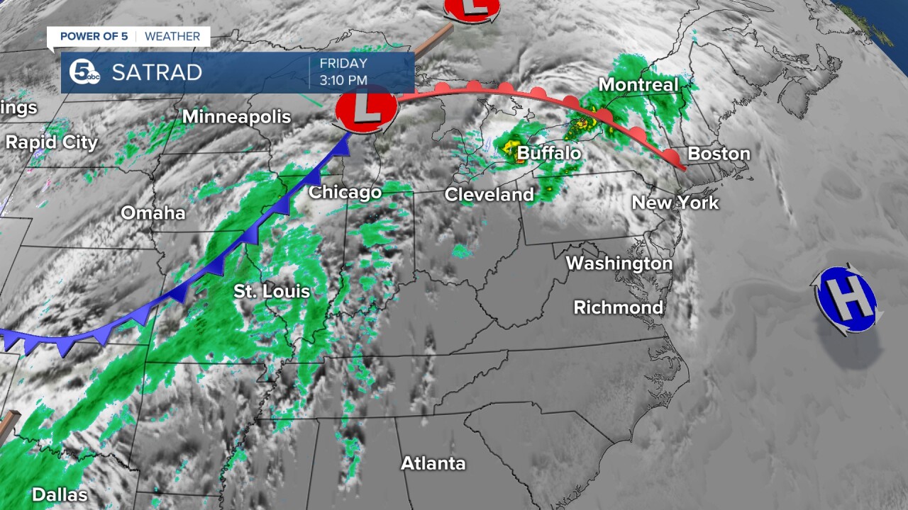
Set up
The warm front (the red line) moved through Northeast Ohio Friday morning, bringing a surge in temperatures and kicking up our winds.
The trailing cold front (the blue line) will slide through on Saturday, bringing an increased threat of rain and storms.
That cold front will drop our temperatures back to the 50s and also stall over the area for the rest of the weekend.
Friday
Good Friday will be mainly dry except for a couple of isolated showers and maybe a storm or two. A few storms skimmed our northeasternmost communities, but most of our area has stayed dry with variable clouds.
It has also been very warm, too! Temperatures are in the upper 70s to the low 80s, with increasing winds out of the southwest. Gusts could be over 40 mph on Friday.
Rain chances will increase late on Friday and into Saturday.

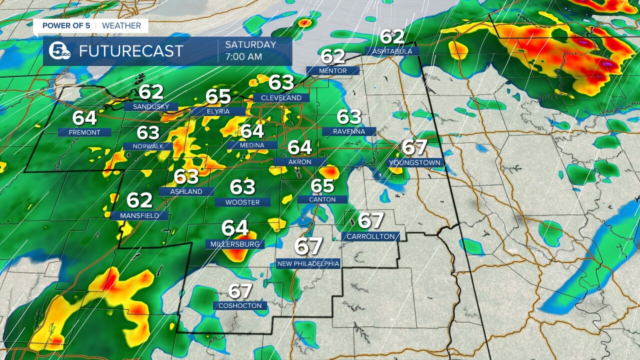
Saturday
Saturday has the best chance of rain or storms over the weekend, with much cooler temperatures than on Friday.
The high temp on Saturday will likely be around 70 degrees, but will drop into the low 60s in the morning and into the 50s by the afternoon.
The heaviest rain is expected during the first half of the day, but we will keep a shower chance through the entire day, although the intensity and coverage will be lower than earlier in the day as we try to dry out.
Scroll through the images of Futurecast to get an idea about the timing and coverage of rain on Saturday.


We will also be watching for any storms that could become strong or severe on Saturday morning into the early afternoon.
A marginal risk for severe storms, or a level 1 out of 5, has been posted from the Storm Prediction Center for the southern half of our viewing area.
The main threat will be damaging winds, but we will be watching for hail, lightning, and heavy rain. The tornado threat is low, but never zero.
There is still uncertainty about how intense the storms will be on Saturday, but it's always a good idea to be weather-aware, especially over a holiday weekend.
There is a greater chance of severe weather to the west and south of our viewing area.

Sunday
Easter Sunday looks to be much drier than Saturday, but there is still a chance for a couple of lingering and lighter showers.
It will be a bit cool for late April, with temperatures in the mid-50s.
Be sure to check back for the latest information because I will continue to update this article over the next few days!
Stay safe and dry, and I hope you have a great weekend.

Want the latest Power of 5 weather team updates wherever you go? Download the News 5 App free now: Apple|Android
Download the StormShield app for weather alerts on your iOS and Android device: Apple|Android
Click here to view our interactive radar.
Read and watch the latest Power of 5 forecast here.
Follow the News 5 Weather Team:
Mark Johnson: Facebook & Twitter
Trent Magill: Facebook & Twitter
